By early November Virginia is getting cold and it was time for us to leave and head south. Whilst only 700 or so nm, the trip from Virginia to the Bahamas has a couple of interesting aspects: First you must round the notorious Cape Hatteras, one of the most feared headlands on the US East coast, then you must cross the Gulf Stream, the north east stream of water that flows up the East coast.
Finding a weather window long enough to give acceptable breezes from the right direction can be a challenge. From a sailing perceptive, wind behind is preferable but since the Gulf Stream flows north east, that would give wind against the current, which can make both Cape Hatteras and the Gulf Stream nasty and potentially quite dangerous.
After a couple of shopping trips the boat was fully stocked so that we could be self sufficient if we needed to, when when stopping in islands still recovering from the hurricane season. Boat preparation, included fitting a new radar and chart plotters was completed, so we were ready and waiting for the weather. Finally on the morning of Wednesday 15th November the weather window was the best we were likely to get for the foreseeable future – equally importantly, all the different weather models we use finally agreed!
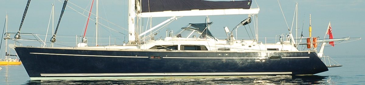
We left Norfolk Virginia at 14:00 on Wednesday 15 November in the company of Tourterelle and Aura, some friends who had also been waiting for the right weather and who were heading down the US East coast. After passing the huge navy base and the most enormous aircraft carriers, complete with patrolling Black Hawk helicopters we headed out to sea. We were hot on the heels of Lady Rebel who had left earlier in the day and who were also heading for the Bahamas.
Our passage was predicted to be between 4-5 days and after a night at sea riding the last of the south going Labrador current, we approached Cape Hatteras. The shift pattern was organised with Hatteras in mind. Lesley determined that she would be ‘off watch’ around the Cape, which suited Derek since he wanted to be ‘on watch’!
There are many strategies for rounding the Cape, depending on the weather. We had some North in the wind and the Gulf Stream charts were showing it converging quite close to the Cape, so we opted for a tight rounding, inside the Gulf Stream and in fact inside the old abandoned lighthouse and outer buoys. The routing worked out well and the rounding was thankfully uneventful and was followed by a stunning sunny, though slightly chilly afternoon before a beautiful sunset.

Next was crossing the Gulf Stream. Our latest downloaded charts showed that there should be a narrowing of the stream where we could enter it about 2am and be out by about 8 am, but we got a call from Lady Rebel on the VHF to say their weather router had advised them to ensure they were not in the stream after midnight due to some potentially nasty weather. this led to some rapid downloading of weather info which was a bit inconclusive, but we opted to abandon the slight southerly push we were still getting from the Labrador current and head SE immediately to cross the Gulf Stream, which we could do by about 2am. The plan worked and we hardly noticed the change in water state, just a difference in our speed over the ground.
Once we moved away from the coastline and deeper into the Atlantic there was a familiarity. We settled into a loose shift pattern mostly 4 hours on and off watch although daytime was flexible. Most importantly, the temperature was rising, with less technical sailing clothing needed at night!
Away from the USA shore the night skies were amazing. We had a clear sky most nights and the dawn and sunsets that we had missed being on the east coast were good for the soul, a great sense of freedom and at one with the rhythm of the earth and nature.
The remainder of the trip was a little light on wind, involving a fair bit of motor sailing, but the seas were relatively flat and we could relax. Our water generator managed to hook two abandoned fishing buoys, complete with 100+ metres of rope and the propeller got completely fouled by an abandoned fishing net 30 miles N of the Bahamas, meaning we had to completely stop, to allow Derek to don the diving gear and cut it away. Thankfully the water was crystal clear and not too cold.

Not to be outdone by the boat, and despite the fact that the freezer was packed full from the supermarket, the fishing lines went out and in addition to a lot of seaweed, a nice 10 kg Skipjack Tuna, was landed filleted and frozen.


We approached the Bahamas via the Nunjack Channel, a wide deep cut through the north Abaco reef and after 4 days and 2 hours we dropped anchor just before sunset in turquoise clear water in the first bay we found, romantically named ‘Rat Cay’. After a sundowner, a tidy up and some dinner, we slept peacefully for the first time in 4 nights.
Stats for the trip:
Log distance: 779 nm (probably a little high)
Wind: Max 25 kts, Min 3 kts
Lost: one winch handle (Derek’s stupidity)